
University Place ZIP Coverage
Two verified postal codes form the practical core of a University Place ZIP code directory. The city adopted 98466 and 98467 as its ZIP geography in official planning material. Both also appear in the county ZIP layer. Postal codes describe mail routes, not municipal power, school enrollment, parcel ownership, or proof that a named person lives at an address.
| ZIP | Areas Covered | Post Office | Notes |
|---|---|---|---|
| 98466 | University Place delivery area and adjacent Tacoma-address geography | University Place Post Office | Main civic and postal code; boundary may cross the city line |
| 98467 | University Place delivery area, including western and Chambers-area geography | Served through local USPS routes | Shares the same city-limit mismatch problem |
| 98464 | Not verified as a separate city-serving area | Ask USPS | Possible special or PO-box claim remains a research gap |
Do not promote 98464 to a local code without a live USPS result or written postal confirmation. Official sources reviewed did not verify the claim. The University Place Post Office itself is at 6817 27th Street West, Tacoma, WA 98466. Its Tacoma mailing city illustrates why a postal label and the incorporated city are different facts.
Verify University Place Postal Codes
The USPS ZIP Code Lookup is the source for the current postal form. It offers searches by full address, by city and state, and by ZIP to find associated cities. Use the full street line whenever possible. An address result can supply the standardized city name and ZIP+4, while a city search can show codes tied to that mailing place.
| USPS Field | Type | Needed | Use |
|---|---|---|---|
| Company | Text | Optional | Add for a business address |
| Street and unit | Text | Address mode | Enter the delivery line |
| City and state | Text/select | City mode | Find current ZIP codes |
| ZIP | Text | ZIP mode | Find cities linked to a code |
See the official USPS lookup interface.
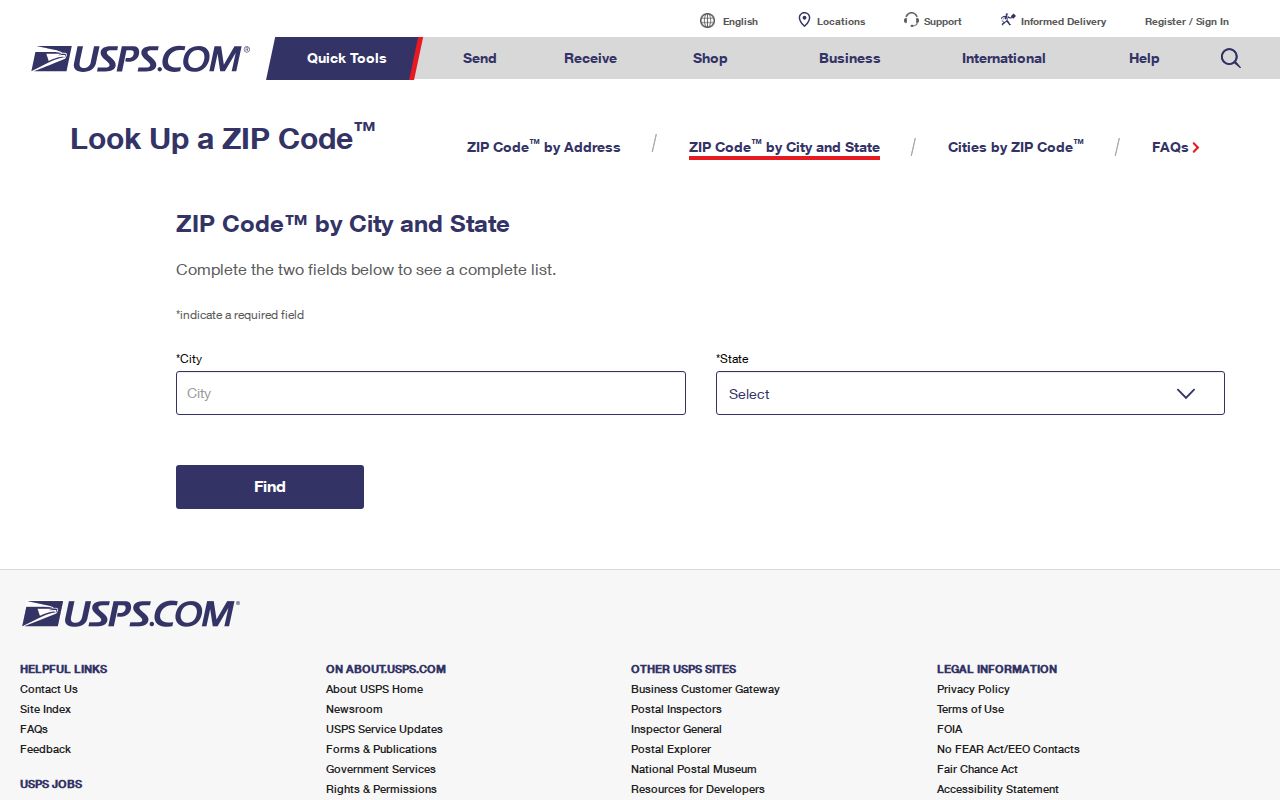
The three search modes answer different questions. None confirms a resident's identity or presence at the returned address.
Find University Place Residents by ZIP
A ZIP code directory reduces the search area before a parcel or name check. Pierce County's tax-parcel metadata includes mailing ZIP, taxpayer name, site address, land-use, value, and tax-area fields. Yet the mailing ZIP can belong to the taxpayer's delivery address rather than the parcel. PublicGIS can orient the user to a ZIP area and parcel, but the map is not a legal survey.
- Verify the full address with USPS and save the standardized ZIP and ZIP+4.
- Open Pierce County PublicGIS and search the address, intersection, parcel, or place.
- Identify the parcel, compare its site address with delivery fields, and follow county property links.
- Use the Assessor-Treasurer parcel search for the current tax record. Exact advanced ZIP fields were not exposed in research, so do not assume a ZIP-only owner query exists.
- Once a road is known, use the University Place street directory for the street-level record chain.
Voter records require separate care. VoteWA handles an individual lookup. Statewide voter-file requests now route to the Secretary of State under the 2026 change and are governed by public-field, confidentiality, and permitted-use rules. A postal area is not permission to assemble a private household list.
University Place ZIP Boundary Limits
Pierce County builds its reference ZIP geography from county roads and USPS ZIP+4 address data. The official metadata says some road segments can carry more than one ZIP. It also warns that ZIP boundaries are approximate and may not match city boundaries. The February 2026 dataset refresh makes it useful for current orientation, but not for proving jurisdiction.
This mismatch affects record routing. A mailing label may say Tacoma while the parcel lies in University Place, or a University Place postal code may extend beyond the city. Confirm the parcel in GIS, then use the city boundary and responsible agency. City permits go to University Place for covered property; county taxes and recorded deeds remain Pierce County functions.
- ZIP
- A five-digit USPS delivery area, not a municipal boundary.
- ZIP+4
- The base ZIP plus four digits that narrow a delivery segment.
- PO-box ZIP
- A code used mainly or only for post-office boxes.
- Unique ZIP
- A code assigned to one high-volume organization.
- Carrier route
- A group of addresses served in one postal delivery route.
Boundary check. Use USPS for mail, county GIS for map context, and the responsible custodian for the legal record.
University Place ZIP Map Update
The Pierce ZIP GIS metadata lists a publication date of February 27, 2026 and a data ending date one day earlier. The county labels the layer for annual updates. That timely refresh helps explain why a static ZIP map can lag behind the official reference data. Searchers should still recheck USPS because the county layer is derived in part from postal address information and remains approximate.
The ZIP layer can include ZIP, postal city, state, county, and shape data. It works best as a bridge: ZIP area to road, road to parcel, parcel to assessor record. It should not be used to infer who lives within a polygon. PublicGIS supplies address and intersection search, identify controls, and layers, while the Assessor supplies the tax record.
Note: Save the GIS publication date with any map note, since annual updates can change a boundary segment or postal-city label.
Compare University Place Address Fields
A parcel record may carry several address concepts. Site_Address is the physical situs location. Delivery_Address is the taxpayer's mailing street. City_State and Zipcode also describe the mailing address. The taxpayer name is a public tax-roll clue, but county metadata warns that it is not by itself an ownership determination. A value of XXX in a site number means the house number is unverified.
This contrast is one of the most useful ZIP code directory checks. If USPS validates one postal address but the county shows a different tax delivery address, do not merge them. Record each field under its own label. Then check the deed index for legal ownership and the parcel geometry for the physical location. Current parcel systems answer a tax question; historical directories answer who was printed at an address in a given year.
University Place Post Office Quirk
The local USPS facility is named the University Place Post Office, yet its official address uses Tacoma as the mailing city. That is not proof that the facility lies outside the incorporated city, nor does it change the civic identity of University Place. It is a clean, local example of postal naming serving delivery rather than municipal geography.
Use the USPS location page for current phone and retail hours before a visit. Postal staff can answer delivery and box questions. They cannot certify parcel ownership, city jurisdiction, voter eligibility, or a person's residence. Those questions belong to the county, city, election office, or record custodian.
Older University Place ZIP Searches
University Place incorporated in 1995. Earlier sources may index the same place as Tacoma suburban or unincorporated Pierce County. A historical search should preserve the address, road suffix, directional, and old place label rather than forcing the modern city name into every query. Tacoma Suburban Polk directories are often more useful than Tacoma-only volumes for mid-century residents.
Historical maps also predate current ZIP geography. The 1895 Tacoma and environs map and 1890 Pierce County map help with old place names and lot context. They do not supply current postal codes. For a named person, pair the old directory or map with an obituary, deed, census, or archive record, and state the date of each source.
Request University Place ZIP Records
If the map or portal does not answer the question, use the fallback chain. Contact USPS for postal standards. Ask Pierce County GIS about layer meaning and Assessor-Treasurer staff about parcel fields. Recorded ownership evidence belongs with the Pierce County Auditor. City Hall can route University Place planning, permit, and code records, while county and regional agencies hold many contracted services.
For a city record, the University Place Public Records Request Center accepts requests and explains custody. Give the exact address, both possible ZIP codes, a date range, and the record type. Under RCW 42.56.520, an agency generally responds within five business days by producing records, acknowledging with an estimate, seeking clarification, or giving a lawful denial. Older items may require mail, a counter, a library, or the Puget Sound Regional Archives.
A ZIP code is a search aid, not identity proof. Keep lawful personal research narrow, verify each result with its custodian, and respect protected addresses.